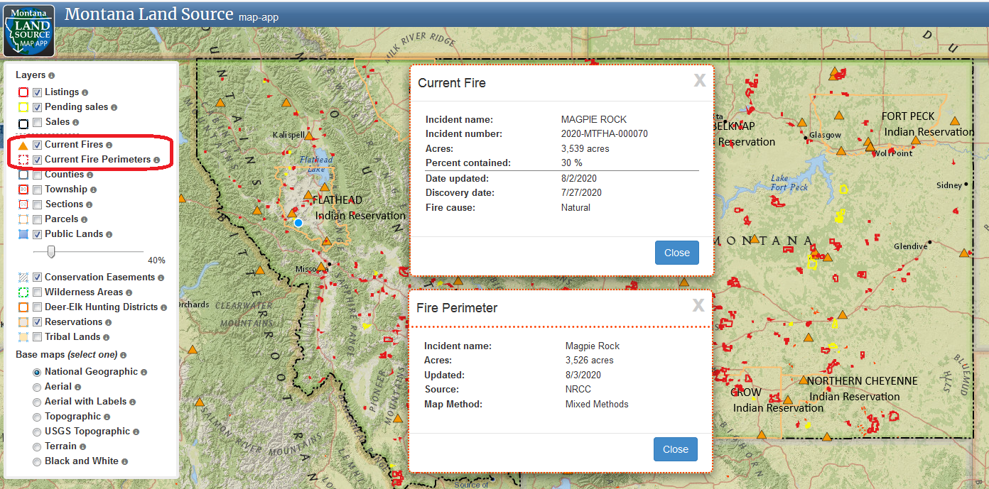
Wildfire season is upon us in Montana, and so the Montana Land Source map application features two active wildfire layers provided by the National Incident Feature Service (NIFS). The two layers provide the most up-to-date information and mapping available on wildfires in Montana, and allows users of our map app to view active wildfire information in relation to other map features, including active land listings and sales.
- The first layer shows a triangle at the location of the fire, and when you click on the triangle, the information pop-up has the most current and up-to-date fire information.
- The second layer shows fire perimeters if the fire has been mapped. Not all fires are mapped in Montana, and it can take days or even weeks for fires to be mapped and for the perimeters to be made available.

Category:
